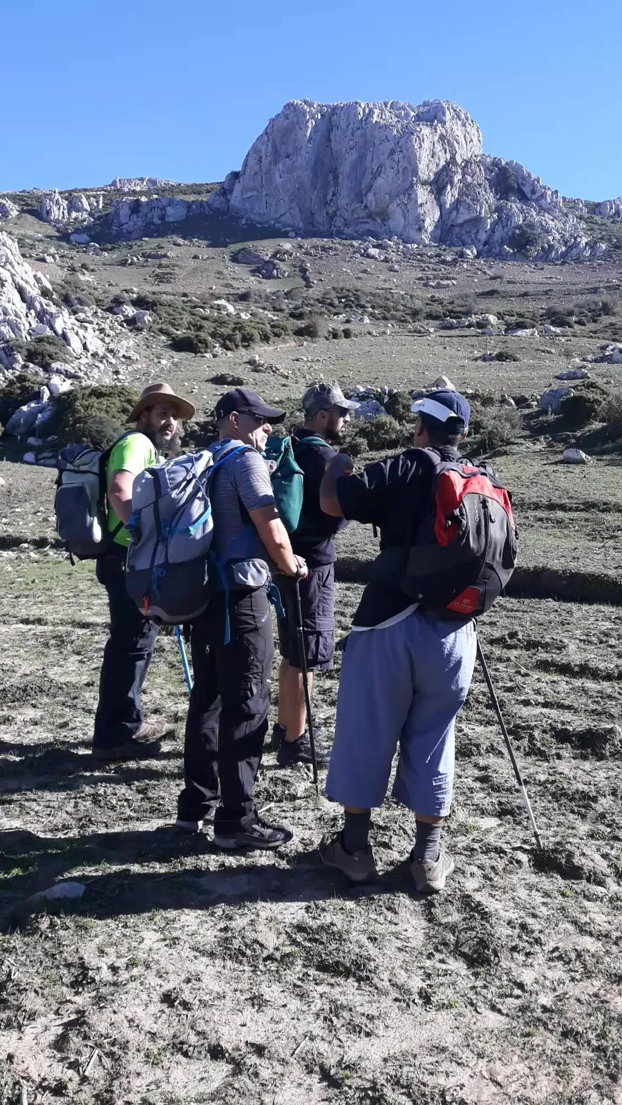
The Tetouan mountains can be explored on foot, whether you are a beginner looking for a half day close to town or an experienced hiker aiming for a summit above 1,500 m. Routes here are sorted by height, walking time and difficulty, and their summits are documented in the field on rando.ma, the mountain encyclopedia of Tetouan and Chefchaouen provinces. This article gives you the key data for each level, with the sheets and tools you need before setting off.
What sets this area apart is that you do not need hours of travel to reach the mountains. Some routes start right at the edge of town; others take two full days and serious kit. The gap between them is wide, so start here by knowing where you stand.
At a glance
- For beginners: short routes with under 300 m of ascent, suited to a half day.
- Intermediate: summits up to 838 m, with two to four hours of walking.
- For experienced hikers: summits above 1,200 m and up to 1,926 m, needing full kit and sometimes an overnight stay.
- Best times: mid-April to June, and September to early October.
- Tools available: free printable sheets, field articles and a specialist mountain-guide service.
What makes the Tetouan mountains a real hiking destination?
The location of Tetouan is genuinely rare: it lies in the plain of the Martil river, between the heights of the western Rif on one side and the Mediterranean on the other. Being a few metres from an old medina listed as UNESCO World Heritage since 1997, and a few steps from the start of a real mountain path, is not something you find often. Jbel Dersa, about 541 m high and directly overlooking Tetouan's old medina, is a natural starting point for anyone wanting a first outing without going far.
The western Rif is not just mountains passing by in the background. It is a whole belt of summits, villages and valleys, each with a tribe's name, a precise height and a documented administrative belonging. This is what the encyclopedia rando.ma offers: a field database covering 34 mountains and summits and 38 villages and communes in Tetouan and Chefchaouen provinces, with the interactive height ladder that shows every known summit on one scale. Before you choose your route, this tool is the first thing you need.
Where to hike around Tetouan? Documented routes for every level
Beginner routes: a half day close by
The Merza-Dalia loop is one of the easiest documented options in the area: about 7.7 km with roughly 198 m of ascent, rated easy. It suits families and people short on time who still want a real walk. The route known as Balade Zarka near Kitane is a similar option, of comparable length with about 222 m of ascent.
What these two routes have in common is ground you can walk without navigation devices or climbing gear, at a pace that suits everyone. But do not set off without enough water and proper hiking boots, even on easy routes.
Intermediate routes: summits worth the effort
The Alaouiyine–Fahs Lemhar and Jbel Labyad route starts from the douar of Alaouia and climbs to the summit of Jbel Labyad at 838 m. Reaching Fahs Lemhar takes about two hours of easy walking, with steeper sections near the top. The path crosses mountain pastures and views that reveal the province from above. The Jbel Labyad page is available on rando.ma for anyone who wants to plan ahead.
This kind of route suits people used to walking two to four hours with under 1,000 m of ascent. The effort is real, and the view is worth it.
Routes for experienced hikers: high summits and mandatory preparation
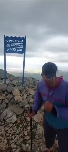
Jbel Bouzitoun (1,215 m) takes a 23.4 km route with about 1,408 m of ascent, rated 'very hard'. The four-summits route in the Haouz of Tetouan covers 31.6 km with 1,072 m of ascent and about 7 hours 47 minutes of walking. These are not numbers to take lightly.
Jbel Kelti (1,926 m) is the highest summit in the province, and its last 900 m include very steep sections in places. The route needs high fitness and experience of rocky terrain, and it is best organised over two days with a night at around 1,100 m. Spring and autumn are the best seasons for these summits; avoid cloudy or rainy conditions at these heights altogether.
The summits and villages along the way
The main documented summits in the province and their heights
Tetouan province has a series of studied and documented summits, each with its precise tribal and administrative belonging. These are the main ones:
- Jbel Kelti: 1,926 m, Beni Hassan tribe.
- Jbel Hafat Zeltan: 1,821 m, Al Hamra commune, Beni Hassan.
- Jbel Idmamen: 1,697 m, El Oued commune, Beni Hassan.
- Jbel Tellouja: 1,681 m, Beni Hassan tribe.
- Jbel Ghorghiz: 1,237 m, Beni Hozmar mountains, south of the town of Tetouan.
The details of each summit, from its exact height to its tribe, commune and nearby places, are documented in detail on the rando.ma pages. This is not scattered data but a coherent encyclopedia you can turn to before every trip.
The Jbel Ghorghiz guide, Tetouan
Mountain villages within walking distance: beyond the summit
The douar of Alaouia and Saddina are among the nearest villages you can reach on foot from the edge of town. The walk from Alaouia to Fahs Lemhar takes about an hour to an hour and a half, through mountain pastures that reveal the Beni Ider and Beni Hozmar country. Tazarine Zitoune and Dar Akhnous Asaaden are hamlets near the Jbel Ghorghiz route, good destinations for a full mountain day.
A mountain route is not complete with just the climb and descent. Adding a village to the route adds another dimension: knowing these villages' tribes and history turns the trip into a geographic and cultural experience at once, and that is exactly what rando.ma documents.
How to prepare before heading into the mountains
Choosing the right route is half the preparation. The other half is the right timing and the right tools; here is what you need to know before you leave.
The best times to hike around Tetouan
The best window of the year is mid-April to June, and September to early October. In these two periods temperatures are mild, nature is at its best and the paths are open. June is excellent for morning walks before the heat builds, and October is cooler and quieter, with rain possibly starting towards the end of the month.
Winter is harder: damp, fog and rain change a route's real difficulty a great deal, and some paths become slippery and unsafe. Being close to the sea means fast weather changes, so check the forecast on the day and do not head for the high summits in cloudy weather.
Sheets and maps: everything you need before you leave
rando.ma offers 10 free printable PDF files: packing lists, trail cards, an emergency card and a hiking logbook, all available in three languages. These sheets are field-planning tools built on the region's data, not just generic lists. If this is your first mountain trip in the area, start with the packing-list sheet before anything else.
Besides the sheets, rando.ma has field articles built on the encyclopedia's data describing summits, villages and parks such as Talassemtane and Bouhachem. It is all in one place, with no need to gather information from scattered sources.
Do you need a mountain guide for hiking around Tetouan?
When does a guide become a necessity rather than an option?
Easy and intermediate routes near town can be done alone or in a small group, as long as you prepare well and check the weather beforehand. Routes such as Jbel Kelti, Bouzitoun and the four summits are a different story altogether: rocky terrain, steep slopes and changeable weather make a specialist companion real added value, not a luxury.
What the mountain-guide service via rando.ma offers
rando.ma is linked to the services of mountain guide Imad Ben Yahya, who runs guided outings in the Tetouan and Chefchaouen mountains for groups of 1 to 12 people. The service suits both a beginner on a first mountain trip and an experienced hiker aiming for a hard summit. You can contact me directly through randonnee.ma to find out the options and choose the route that best fits your level.
Request an outing around Tetouan
The Tetouan mountains are waiting for those who know how to reach them
Nothing is far here. Jbel Dersa looks down on the town, and Jbel Kelti takes two days of real effort. Between these two ends you will find something for your level, as long as your information is accurate and your preparation well thought out.
Start with rando.ma: with the packing sheet before your first trip, with the page of the summit you are aiming for, or by contacting me to book a guided outing. The data is there, the routes are documented and the mountains are waiting. Tetouan's mountain landmarks are more than what you see from the car window, and this article is only the beginning.
FAQ
Can I walk the easy routes on my own, or do I need someone with me?
You can walk the easy routes alone if you are well prepared and watch the weather. Easy routes such as Merza-Dalia and Balade Zarka suit families and people short on time, but you must bring enough water and hiking boots, and not go up in cloudy weather.
How do I decide whether I need a mountain guide?
You need a mountain guide on hard, high routes such as Jbel Kelti or Bouzitoun, where the terrain, the slopes and the changeable weather make guiding a necessity. For nearby and intermediate routes you can walk alone if you prepare well; for the high summits, I advise you to contact me, guide Imad Ben Yahya, through randonnee.ma.
What should I use the packing sheet for before I go?
The first thing you need is the packing-list sheet, one of the free sheets available on rando.ma. These field sheets are built on the region's data and help you know what gear you need depending on the route's length, difficulty and the weather.
Should I plan a night in the mountains, and when?
Some high summits need an overnight stay: Jbel Kelti, for example, is best organised over two days with a night at around 1,100 m. Long, hard routes such as Bouzitoun and the four summits need full kit and may be best in mid-spring or autumn.