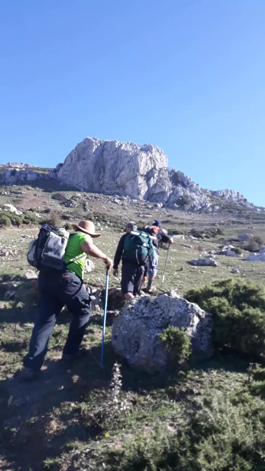
If you are in Tetouan, you do not need to travel far to walk in the mountains. South of the Martil river, directly facing the town, rises the limestone massif of Jbel Ghorghiz, which locals call 'Jbel al-Idhaa', the Radio Mountain. It is one of the closest mountains to the town, and it draws even more people in winter, when snow covers it on some very cold days.
In this guide I introduce the mountain as I know it, as a guide in Tetouan and Chefchaouen: where it is, how high it is, the villages and peaks around it, when to go and how to prepare for a snow day.
Jbel Ghorghiz at a glance
- Location: south of the Martil river, facing Tetouan, in Tetouan province.
- Local name: Jbel al-Idhaa (Radio Mountain), with transmitter towers on the summit.
- Size: a limestone and dolomite massif covering about 60 km².
- Highest point: the al-Idhaa summit, 1,237 m; its peaks and paths range from 800 to 1,237 m.
- Usual start: Bouanane, on the edge of Tetouan.
- On its slopes: Bousemlal village, known for its springs and orchards.
Where is Jbel Ghorghiz?
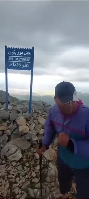
Jbel Ghorghiz lies in Tetouan province, south of the Martil river, facing the town. It is a massif of limestone and dolomite formed about 200 million years ago, covering about 60 km²: some 80% of the commune of Zitoune and 20% of Ben Karrich. Its slopes hold the last cork oaks of the upper Beni Hozmar mountains. Its southern ridge includes Jbel Tamim, or Kmim, in Beni Hozmar country, in the commune of Zitoune. Beside it rises Jbel Bouzitoun, about 1,215 m; together they form the highest summits facing Tetouan.
Why is it called the 'Radio Mountain'?
The summit of Ghorghiz carries transmitter towers that can be seen from town, and people in Tetouan call the mountain 'Jbel al-Idhaa', the Radio Mountain. So you will find both names, Jbel Ghorghiz and Jbel al-Idhaa, and spellings such as Jbel Ghorghiz or Jbel Grgiz.
How high is Jbel Ghorghiz? The summits of the massif
The highest point of Jbel Ghorghiz is the al-Idhaa summit, at about 1,237 m, with the Hafat Safa ridge at roughly the same height. Its peaks and paths range from 800 to 1,237 m. These are the main summits of the massif:
| Summit | Height | Note |
|---|---|---|
| Al-Idhaa summit | 1,237 m | Highest point, with the transmitter towers |
| Hafat Safa | 1,237 m | A ridge at about the same height |
| Jbel Bouzitoun | 1,215 m | One of the best-known summits |
| Jbel El Jnane | 984 m | Above Bouanane |
| Kodiat Taher | 972 m | Site of the battle of 3 November 1926 |
| Jbel Bourja (Qalaat Ghorghiz) | 931 m | Above Beni Salah |
| Hafa Hamra | 868 m | Above Ben Karrich |
| Jbel Tamim | 855 m | On the southern ridge |
Kodiat Taher is more than a summit; it is a place of memory. On 3 November 1926 a battle of the resistance against colonial rule was fought there, in which the resistance fighter Ahmed Asbou Akhrirou was killed.
Where do Ghorghiz hikes start?
Most routes start from the Bouanane area on the edge of Tetouan. From there you can head down to the springs and waterfall of Bousemlal, or climb via Jbel El Halqa and Tazarine to the summits. The usual track from Bouanane up the mountain is about 15 km long and of moderate difficulty. The nearest villages are Dar Akharkhour, Tazarine Zitoune and Dar Akhnous Asaaden.
Getting to the start is easy: Bouanane is only minutes from central Tetouan, by car or by taxi from town. That is why most visitors start there.
Bousemlal and the villages of Ghorghiz
On the slopes of Ghorghiz lies Bousemlal, one of the oldest settled places on the massif. Local memory calls it 'Charifat Tetouan' for its rich land, the quality of its water, its orchards and its plentiful springs. The massif has other well-known springs, including Ain Zarqa, Ain Bouanane and Ain Beni Salah. Walking between these villages is part of the mountain's charm, provided you respect the people who live there: the springs are their drinking and irrigation water, and the orchards are their livelihood.
Snow on Jbel Ghorghiz
In winter, on some very cold days, snow falls on the al-Idhaa summit and Ghorghiz turns white; it becomes the outing of choice for many people from Tetouan and nearby, with interest in the mountain peaking in January. Snow on a mountain facing the town is a rare and beautiful sight, but a snow day needs preparation:
- Check the Jbel Ghorghiz weather on the morning you go: snow does not last long and conditions change quickly.
- Roads and paths can be slippery with snow or ice: good-soled boots are essential and poles help a lot.
- Wear warm layers, gloves and a hat, and bring a hot drink.
- Winter days are short: start early and be back before dark.
- If fog comes down, stay on the known path or turn back.
Read also: hiking in winter and snow
Best time to hike Jbel Ghorghiz
- Spring: the springs are flowing and the slopes are green, the finest season for walking between villages.
- Autumn: mild weather and, on many days, clear views over Tetouan.
- Winter: for snow on the coldest days, as long as you prepare well.
- Summer: early mornings only, and beware of fire: the mountain has had fires before, so never light one.
Read also: the best seasons for hiking in northern Morocco
Hiking Ghorghiz with guide Imad
If you would rather not worry about planning, transport and logistics, I know the Tetouan and Chefchaouen trails from the ground. I run day trips and weekend trips to Jbel Ghorghiz, with transport and meals, a night in the mountains if needed, and a close eye on the weather throughout. Groups stay small, from 1 to 12 people, so the pace suits everyone and each person gets real attention.
I choose the starting point according to each group's level, something many people overlook when planning alone: a beginner should not start where an experienced hiker does, and it makes a big difference to the day. A walk between springs and villages for beginners and families, or a climb towards the summit for fitter walkers. If you are staying in Chefchaouen, I arrange the journey via Tetouan, with departure and return times agreed in advance.
Request a Jbel Ghorghiz outing
Simple rules to protect the mountain
- Never light a fire in the woods.
- Carry your rubbish back to town.
- Respect the springs: people drink from them and water their orchards, so leave no trace in them.
- Ask before photographing people or crossing fields.
Read also: leave no trace in the mountains
Safety: what if there is no phone signal?
The mountain is close to town, but do not rely on phone coverage alone: in some ravines and on some slopes the signal can weaken or drop out. For experienced walkers, the right gear and awareness of the risks are enough, along with these simple habits:
- Download the route map before you set off so it works offline.
- Tell someone you trust which route you are taking and when you expect to be back.
- Carry a headlamp, even on a short outing: daylight can run out before the walk does.
- Walking with a guide who knows the paths greatly reduces the risk of getting lost.
More mountains around Tetouan
- Jbel BouzitounAbout 1,215 m, Ghorghiz's neighbour, rich in springs, woods, waterfalls and caves.
- Jbel DersaThe mountain closest to Tetouan, between the villages of Maadel and Serour, among springs and orchards.
- Jbel Labyad838 m, the highest summit of the Haouz hills above Tetouan, with a panoramic view of the town.
- Jbel Kelti and TalassemtaneThe highest summit in Tetouan province, 1,926 m, in the Tetouan part of Talassemtane park.
Jbel Ghorghiz FAQ
Where is Jbel Ghorghiz?
In Tetouan province, south of the Martil river, directly facing the town.
How high is Jbel Ghorghiz?
Its highest point is the al-Idhaa summit, about 1,237 m; its peaks and paths range from 800 to 1,237 m.
Why is Ghorghiz called the Radio Mountain?
Its summit carries transmitter towers visible from town, and that is the name people in Tetouan know it by.
Where does the Jbel Ghorghiz climb start?
Usually from the Bouanane area of Tetouan, either towards the Bousemlal waterfall or via Jbel El Halqa and Tazarine to the summits.
Does it snow on Jbel Ghorghiz?
Yes, on the al-Idhaa summit on some very cold winter days, and the mountain then draws many people from Tetouan. The snow does not last, so check the weather that morning.
Which villages are on the slopes of Ghorghiz?
The best known is Bousemlal, locally nicknamed 'Charifat Tetouan' for its springs and orchards.
Is Jbel Ghorghiz suitable for beginners?
Yes, if you choose a walk between springs and villages. Climbing to the summit needs more fitness, and the guide adapts the route to the group's level.
Do I need a guide for Jbel Ghorghiz?
The mountain is close to town, but the limestone massif has many paths and the weather changes fast in winter. Guide Imad runs outings from Tetouan for groups of 1 to 12 people.
How do I book a Jbel Ghorghiz trip, and what is included?
You can book directly on randonnee.ma. The trip includes transport and meals, a night in the mountains if needed, weather monitoring throughout and a starting point chosen to suit the group's level.
How big are the groups?
From 1 to 12 people. That size keeps the pace right and lets me look after each person, especially beginners.
Can transport be arranged from and back to Chefchaouen?
Yes, I arrange the journey from Tetouan, or from Chefchaouen via Tetouan, by prior arrangement. We set departure and return times before the trip to avoid waiting.
What if there is no phone signal on the mountain?
Do not rely on your phone alone: download the map in advance, tell someone you trust your route and return time, and carry a headlamp. Walking with a guide reduces the risk of getting lost.
Jbel Ghorghiz, right on your doorstep
Close to Tetouan, open all year and varied in its paths: that is what sets Jbel Ghorghiz apart from many hikes in the north. Each season has its own flavour: snow on some January days, green slopes in May, peace and quiet in autumn.
Ghorghiz is Tetouan's mountain: you see it from town every day, and it deserves to be known up close. If you want a comfortable, safe day without the hassle, I take care of the rest. Tell me your group's level and the date, and I will suggest the right outing.