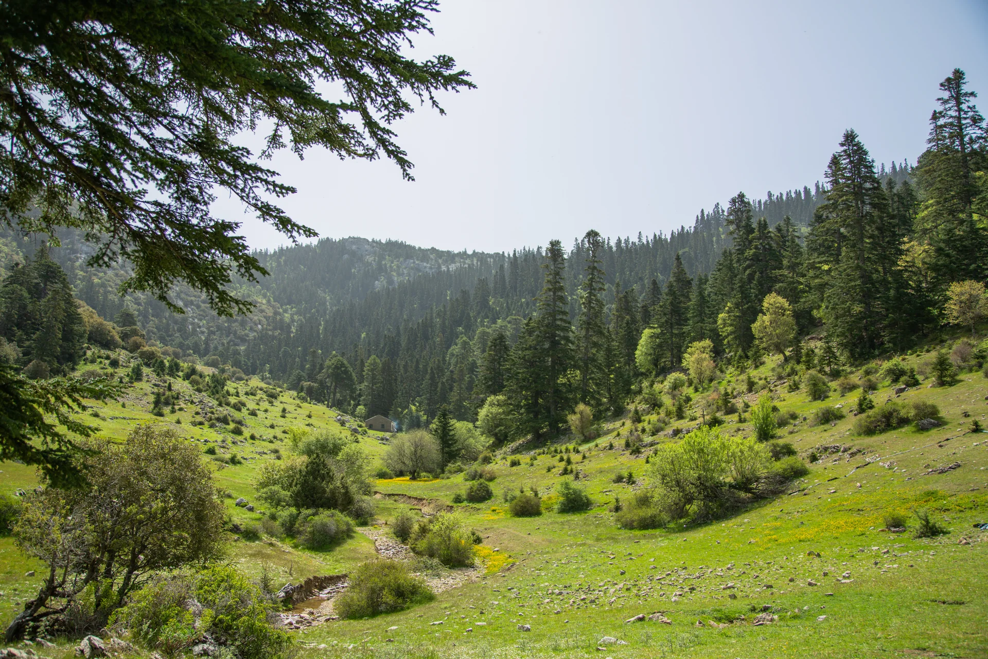
Talassemtane National Park is the heart of the western Rif mountains. It holds the highest summits in northern Morocco, the country's last fir forests, valleys such as Akchour and some of the most remote mountain villages in the north. Yet many people know it only from photos of the Akchour waterfalls.
In this guide I present the park as I know it, as a mountain guide who leads groups there: where it is, its main summits, why its fir forest is unique, which trails suit your level, when to go and where to start from.
Talassemtane at a glance
- Created in 2004 to protect the Moroccan fir forest.
- Area: about 60,000 hectares, mostly in Chefchaouen province and the rest in Tetouan province.
- Highest point: Jbel Lakraa, 2,159 m, the highest summit in the western Rif.
- Best-known entrance: Akchour, about 30 km from Chefchaouen.
- Best time to hike: spring and autumn, plus summer in the valleys and forest with an early start.
Where is Talassemtane National Park?
The park lies in the western Rif mountains of northern Morocco, east of Chefchaouen and south of Tetouan. It covers about 60,000 hectares, more than 70% of it in Chefchaouen province and the rest in Tetouan province. The Tetouan side is less known, but it holds Jbel Kelti, the highest summit in Tetouan province.
Created in 2004, the park is part of the Intercontinental Biosphere Reserve of the Mediterranean, which links areas of northern Morocco and southern Spain and was declared by UNESCO in 2006. The terrain is steep: about 95% of the park has slopes of more than 35%.
The Moroccan fir: why the park exists
Talassemtane was created first and foremost to protect the Moroccan fir, a tree that grows naturally in Morocco only in these mountains. The largest fir forest is on the Talassemtane massif, about 2,270 hectares, followed by the Tazaout massif with about 734 hectares.
These trees grow between about 1,400 and 2,000 metres and can reach 50 metres in height. Walking beneath them early in the morning, in the cool air and the scent of resin, is one of the finest experiences the Rif has to offer.
Read also: the Moroccan fir, how to recognise it and why it is under threat
The summits of Talassemtane
The park holds the highest summits in the western Rif. These are the main ones, with approximate heights from topographic maps:
| Summit | Height | Note |
|---|---|---|
| Jbel Lakraa | 2,159 m | Highest summit in the western Rif |
| Jbel Tissouka | 2,122 m | One of the hardest climbs in northern Morocco |
| Jbel Talousis | 2,005 m | A summit shared by two tribes |
| Jbel Talassemtane | 1,941 m | The mountain that gave the park its name |
| Jbel Kelti | 1,926 m | Highest summit in Tetouan province |
| Jbel El Kelaa | 1,616 m | Right above Chefchaouen |
| Jbel Kharbouch | 1,465 m | At the eastern entrance of the park |
The outline of Jbel Talassemtane is one of the park's best-known images, especially as seen from the southern entrance at Bab Taza. Underground there is another world: the Kef Toghobeit cave, about 772 metres deep, the deepest known cave in Morocco.
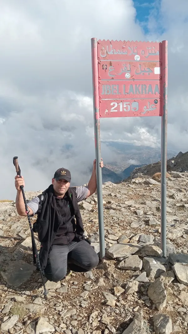
Read also: the mountains of Chefchaouen, the highest peak of each tribe
Wildlife and plants in Talassemtane
Talassemtane is one of the richest natural areas in Morocco. More than 1,380 plant species have been recorded there, some found only in Morocco, along with about 117 bird species, 37 mammal species and 24 reptile species.
Its most famous resident is the Barbary macaque, listed as endangered on the IUCN Red List since 2008. You may come across one in the forest, but sightings are never guaranteed.
The best hikes in Talassemtane National Park
These are the routes I lead in and around the park, from easiest to hardest:
| Trail | Distance | the climb | Time | Level |
|---|---|---|---|---|
| The Chrafat waterfalls | 7 km | +300 m | about 3 h | Easy |
| Akchour and God's Bridge | 9 km | +380 m | about 4 h | Easy |
| Jbel El Kelaa from Ras el Ma | 13 km | +1,000 m | about 6 h | Hard |
| Jbel Lakraa summit | 16 km | +1,050 m | about 7 h | Hard |
Multi-day trek: crossing Talassemtane from Chefchaouen to Akchour
To experience the whole park, I run a 3-day, 2-night crossing: out of Chefchaouen via Ras el Ma and up to the village of Azilane, then a day in the heart of the fir forests and high pastures, and finally the long descent to God's Bridge and the Akchour valley. Nights are spent in a mountain refuge or with village families.
Multi-day treks in Talassemtane
How to get to Talassemtane: the main entrances
- Akchour: the best-known and easiest entrance, about 30 km from Chefchaouen via the N2 and Dar Akoubaa. The waterfall and God's Bridge trails start here.
- Chefchaouen itself: from Ras el Ma, paths lead up Jbel El Kelaa and on towards Azilane, with no transport needed.
- Bab Taza: the southern entrance, with the famous view of Jbel Talassemtane.
- The Tetouan side: through the Beni Hassan villages, such as Tamalout on the northern slope of Jbel Kelti.
Read also: the complete guide to the Akchour waterfalls and God's Bridge
Talassemtane weather and the best time to visit
Spring, March to May
The best season for walking: the rivers are full, the pastures green and temperatures mild. April and May are among the best months to climb Jbel Lakraa.
Summer, June to August
It is hot lower down, but the valleys and the high fir forest stay cooler. Choose routes near water or in the forest, and set off early. Summer is also the fire season, so never light a fire.
Read also: hiking in the summer heat safely
Autumn, September to November
An excellent time for the summits before the heavy rains: skies are often clear and views reach far. September and October are among the best months for Jbel Lakraa.
Winter, December to February
Snow covers the summits, including Jbel Talassemtane and Jbel Lakraa, and fog can roll in fast. Walking in the park is possible on dry days on lower routes; for the summits we adapt or postpone depending on the weather.
Read also: hiking in winter and snow
Where to stay and camp in Talassemtane
The park has a campsite, and some villages, such as Azilane, have mountain refuges that take in hikers. You can also stay with village families, one of the best experiences in the area. Visitors doing only the easy trails usually stay in Chefchaouen and visit the park as a day trip.
Read also: village hospitality and visiting etiquette
Visitor rules and safety in the park
- Never light a fire in the forest, not even for cooking.
- Do not cut branches or take plants or cones.
- Carry your rubbish back to town.
- Stay on the paths, and do not head for the summits alone without knowing the area.
- Respect villages and fields: ask before photographing people.
Read also: leave no trace in the mountains
Read also: mountain safety rules
Why hike Talassemtane with a mountain guide?
Talassemtane's paths are many and look alike, waymarking is rare and the weather changes fast up high. A guide picks the route that fits your level and the season, knows the villages, springs and resting spots, and decides when to carry on and when to turn back. I lead small groups of 1 to 12 people, at a pace that suits everyone.
Book your Talassemtane hike with guide Imad
Talassemtane National Park FAQ
Where is Talassemtane National Park?
In the western Rif mountains of northern Morocco, east of Chefchaouen and south of Tetouan. Most of it is in Chefchaouen province, with part in Tetouan province.
When was the park created and how big is it?
It was created in 2004 and covers about 60,000 hectares.
What is the highest summit in Talassemtane?
Jbel Lakraa, about 2,159 m, the highest summit in the western Rif, followed by Jbel Tissouka at about 2,122 m.
What are the easiest hikes in Talassemtane?
The Chrafat waterfalls (7 km, about 3 h) and Akchour with God's Bridge (9 km, about 4 h). Both suit beginners and families.
Does it snow in Talassemtane?
Yes, in winter snow covers the high summits such as Jbel Talassemtane and Jbel Lakraa. Climbing them then requires proper gear, a guide and suitable weather.
Can you see Barbary macaques in Talassemtane?
The Barbary macaque lives in the park and you may meet one in the forest, but sightings are not guaranteed. Do not feed or approach them.
Can you camp in Talassemtane National Park?
The park has a campsite, and some villages such as Azilane have mountain refuges. On multi-day treks you can also stay with village families.
Do I need a guide to hike in Talassemtane?
Not for the easy Akchour trail. But for the summits, long routes and multi-day crossings, a guide keeps you safe and picks the right way. Guide Imad leads groups of 1 to 12 people.
Talassemtane is more than one famous waterfall: it is summits, forests and villages worth days of exploring. Tell me your level and the season that suits you, and I will suggest the right route.